Scene XI · Seaward
Port-en-Bessin: scallops, stone and cliff paths
A morning-to-afternoon walk through a working fishing harbour, its scallop season, a round stone tower and the GR223 on both sides.
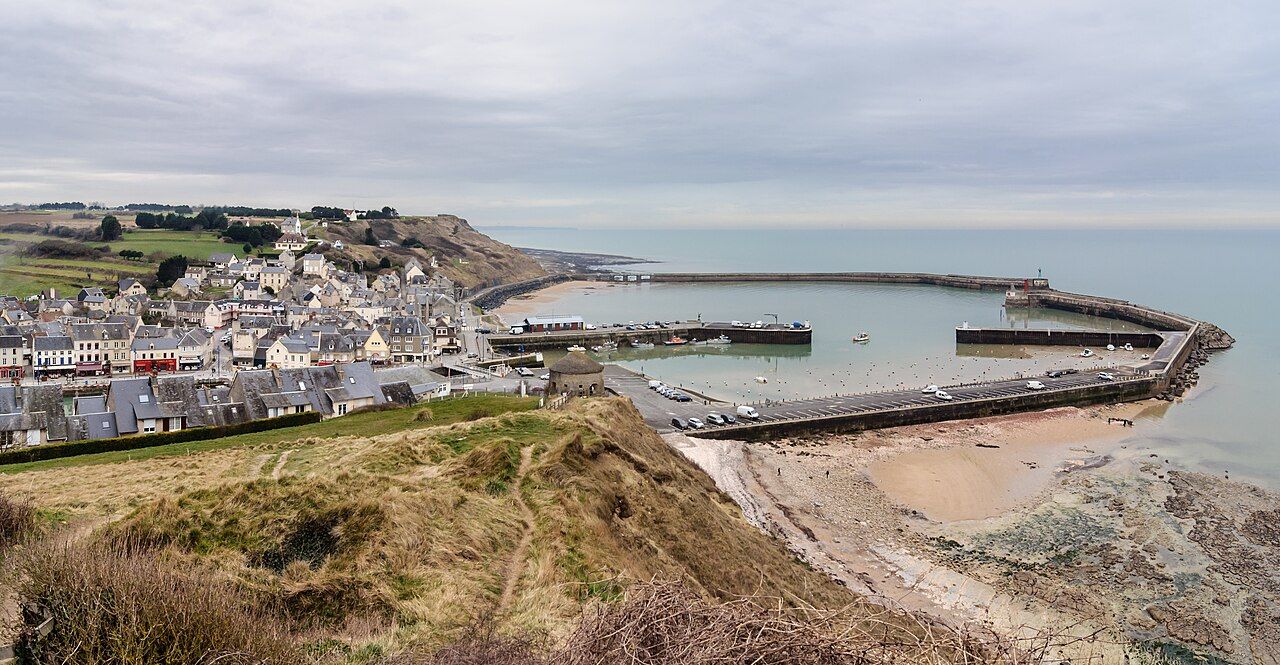

Harbour, piers, and a round stone tower: Port-en-Bessin has its parts in place. What holds the scene together? A fishing harbour, about 10 km north of Bayeux, built around working water and the land rising above it.
What makes morning a good place to start? The harbour’s layout is easy to read before adding its history. Two basins sit inside the piers, dividing the water into clear shapes. The piers make the harbour’s edges; the basins give the boats room within them.
Where does the eye go next? Above the harbour stands a round stone tower, built in 1694. Its shape is plain to name, even if its purpose is not supplied here. I like that the tower makes no effort to compete with the harbour below.
Why linger over the harbour rather than hurry uphill? Because this is a working fishing port, not just a frame for the tower. Port-en-Bessin is one of the main French ports for landing scallops. That fact gives the water a particular purpose.
What does midday add to the view? The scallop season runs through the colder months, roughly October to May. It is a seasonal trade, not a permanent display. The harbour’s identity remains clear beyond those months, even when scallops are not the day’s subject.
Are scallops the whole story? No: the word “landing” points back to the harbour’s practical job. Scallops come ashore here, connecting the sea’s catch with the working port. I prefer that sturdy verb to any grander description; it tells us what happens.
What lies above the harbour on foot? The GR223 coastal footpath climbs onto the cliffs on both sides. Its route makes the harbour a hinge between two higher stretches of coast. Choose a side, and the view changes with the slope.
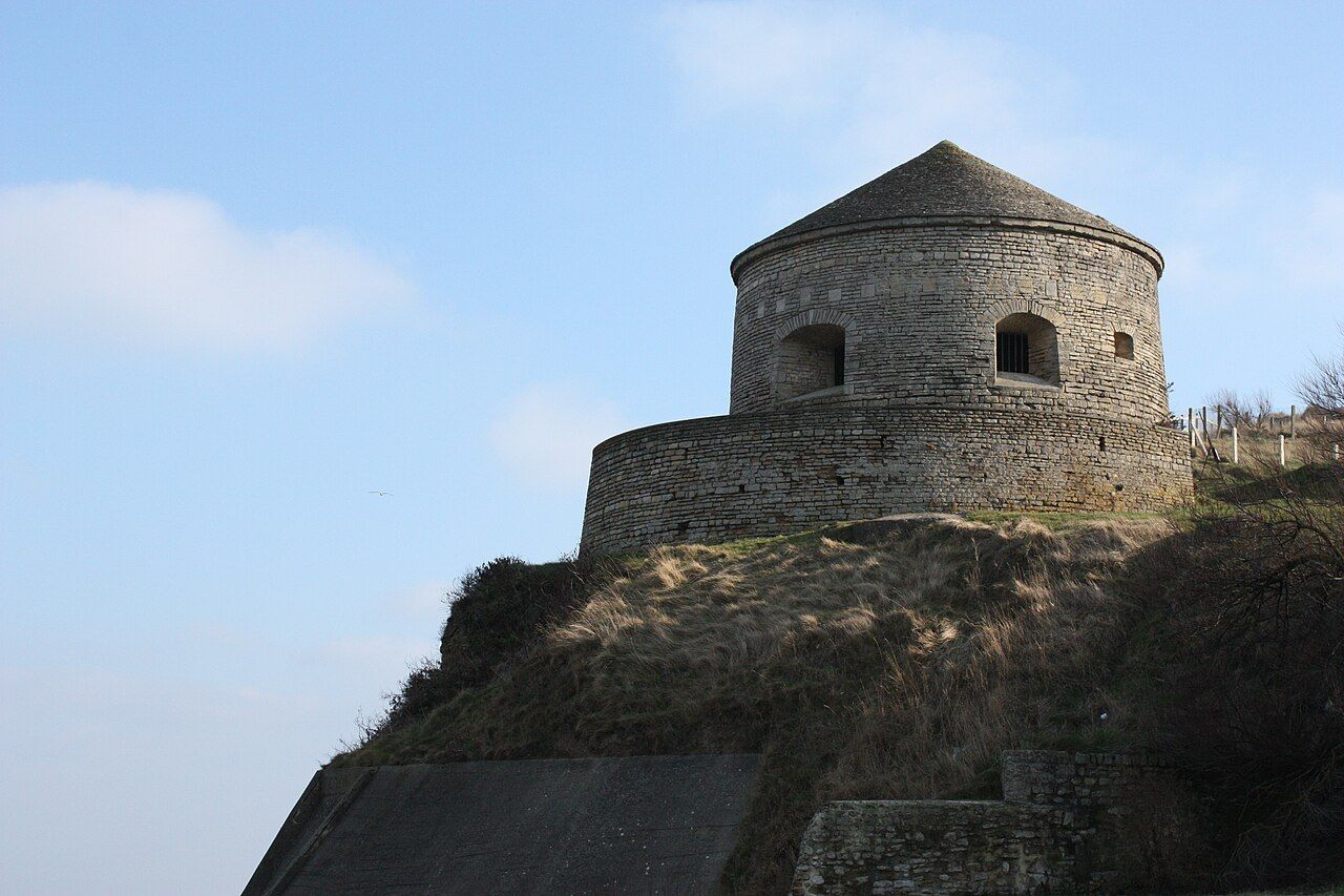

Is the walk simply about getting a higher view? The climb changes the scale: piers and basins become shapes below. The path does not erase the working harbour; it gives its arrangement another angle. That is a better reason to climb than collecting a view.
What belongs in the late afternoon? A slower look at the two sides, and at how the harbour sits between them. The GR223 climbs on both, so there is no single cliff path to claim the whole story. This is where indecision becomes useful.
Does the history change the way the place reads? Royal Marine commandos took Port-en-Bessin on 7 and 8 June 1944. The date belongs beside the present harbour, without turning every basin into a memorial. The port has more than one kind of history.
For another part of the wartime coast, follow the guns still on the cliff. Then return to the harbour’s own firm outlines: tower above, piers around, and two basins within. It is a neat arrangement, though the coast refuses to stay neat for long.
Which side of the harbour deserves the longer pause? The path climbs on both, and the harbour holds the centre. Perhaps the answer depends on whether the tower, the scallops, or the cliffs keeps drawing the eye.
Pull the next thread: Arromanches and the Harbour Towed Across
- Port-en-Bessin is about 10 km north of Bayeux.
- Scallop season runs roughly October to May.
- The GR223 climbs onto cliffs on both sides.
- Which side will hold your attention longer?
- How far from the cathedral about 10 km north
- Where exactly Port-en-Bessin-Huppain
The Guns of Longues-sur-Mer • Arromanches and the Harbour Towed Across